
Click on the map name to see the image.
A map of ANY county or other feature on the Eastern Shore can be obtained at the U.S. Geological Survey Names Server. Using this form interface, you can enter a feature name (ie town, river, cemetery, county, etc.) and obtain a list of matches in the USGS database. Clicking on any listed item will get you a nicely detailed map of the feature. The maps are interactive, so you can zoom in/out or recenter as needed. The Clara, MD map listed below is a map I downloaded from this site.
- 1877 Eastern Shore Atlas
- This series of maps has been scanned by Mike Hitch for his wonderful "Hitch Genealogy" site. Included are maps of the various voting districts of the day for Somerset, Wicomico, and Worcester Counties. They are extremely useful to genealogical researchers because they show names and locations of landowners, churches, and more. A "must see"!
- Experimental survey for the Eastern Shore Rail Road, 1853
- This scan includes only the Lower Shore portion of the map, but it shows landowners and geographic features of the land surrounding the railroad corridor. A neat map.
- Lower Eastern Shore, 1794
- A portion of a "Map of the State of Maryland laid down from an actual survey of all the principal waters, public roads, and divisions of the counties therein; describing the situation of the cities, towns, villages, houses of worship and other public buildings, furnaces, forges, mills, and other remarkable places; and of the Federal Territory; as also a sketch of the State of Delaware shewing the probable connexion of the Chesapeake and Delaware Bays." A really cool map.
- Eastern Shore Parishes
- Scanned from "The First Parishes of the Province of Maryland", published by Norman, Remington Co, Baltimore, 1923, this map shows churches still in use, original churches, an indication of counties as of 1923, counties as of 1695, and also parish names. Many thanks to Craig O'Donnell for providing this map image.
- Lower Shore Area, 1840
- This is a rather large file, so it'll take some time to load. Once it is done, though, you'll see a finely detailed map of the Old Somerset area, showing the pre-Wicomico borders, archaic place names, and waterways.
- Old Somerset, 1877
- This is a scan of the map from the 1877 Atlas of the Eastern Shore, showing Somerset, Wicomico, and Worcester Counties. It shows the election district boundaries, towns, waterways, geographical feature names, railways and more. Since this ended up as a mammoth file in GIF format, the main link is to a (relatively) smaller JPEG image file, which is not quite as clear. If you've got the time, and wish to view the very large, but crisper, GIF file, you can view it here.
- Nova Terrae Mariae
- This is John Ogilby's 1671 "Nova Terrae Mariae" map of the Delmarva area. North is to the right. This map was probably copied from Capt. John Smith's 1607 map. For more information on this and other Maryland history, take a look at The Maryland State Archives Home Page.
- Ellis Bay WMA
- This map shows the Ellis Bay Wildlife Management Area in southwestern Wicomico, along with the surrounding area.
- Johnson WMA
- This map shows the Johnson Wildlife Management Area in southern Wicomico, along with the surrounding area.
- Delmarva Peninsula
- This is a nice, large, colorful map of the Delmarva area, with the lower shore counties marked.
- The 1895 Atlas Project, Maryland
- You'll find detailed, circa-1895 maps of every county in Maryland at this site.
- Old Somerset
- Showing the original county, created in 1666, including its daughter counties with their dates of creation.
- Old Somerset County
- Another view of the original boundaries of the county, which includes what is now Somerset, Wicomico and Worcester in Maryland, and a portion of Sussex in Delaware.
- Somerset Hundreds
- This is a very handy map, from Wilmer O. Lankford's book "They Lived In Somerset: 17th Century Marylanders", showing the "Hundreds" of old Somerset County. Historically the term Hundred began in medieval
times when Britain divided land into what was known as Hundreds, each of
which would produce 100 fighting men in time of war. In the 17th century, Somerset County land was divided into "Hundreds" for administrative purposes and geographical subdivisions.
- Kent County
- Map of Kent County and Chestertown, Maryland.
- Dorchester County
- Color map of Dorchester County, Maryland.
- Somerset County
- Color map showing present-day Somerset County, Maryland.
- Wicomico County
- Colorful map showing the boundaries of Wicomico County, Maryland.
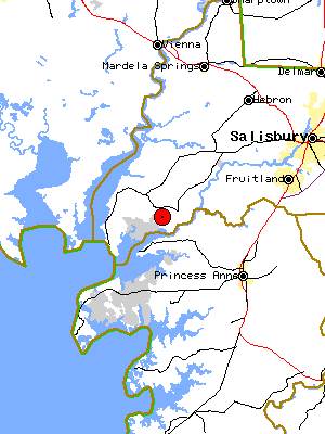
- Clara, Maryland
- Map of SW Wicomico County. Clara, Maryland, a town which no longer exists, was where many of my ancestors lived, including some MEZICKs, ROBERTSONs, WAINWRIGHTs, EVANS, and others.
- Worcester County
- Color map of Worcester County, Maryland.
- Relief Map of DelMarVa
- The USGS, in partnership with MSN and Encarta, offers these neat maps on their Terraserver. This map gives a general idea of the "lay of the land", although I wish it would allow you to zoom in a little closer.
- Topographic Map of the lower Shore
- This is another style of map available from the USGS through the Terraserver. Really good detail, and you can zoom in and out. I love this map.
- National Atlas of The United States
- The new National Atlas of the United States is intended to provide a comprehensive, map-like view into the enormous wealth of data collected by the Federal Government.
- Perry-Castaneda Library Map Collection
- This is a good collection of various old and new maps of Maryland.
- Streetmap.com by Encyberpedia
- This site is a collection of links to many sites on the Internet dealing with maps.
- Mapquest
- Here is an easy-to-use, interactive map site.
- Mapblast
- An alternative to Mapquest, this site has a lot of nice interactive mapping features.